Kori Fm
Type Locality and Naming
Offshore (local): Interval 2350 to 4511 m (sub K.B.) in wells K1-1A (Zutshi et al., 1993)
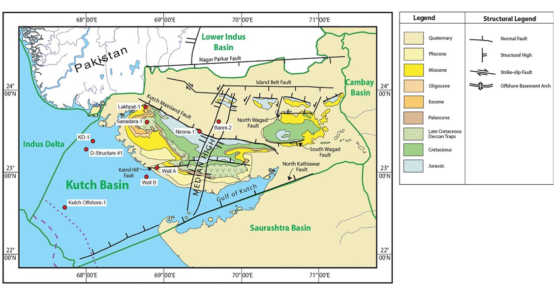
[Fig. Geological and structural map of Kutch, also showing the onshore and offshore wells drilled for oil exploration. (Map by Rasoul Sorkhabi in GeoExpro Dec2014, based on various sources including S.K. Biswas, Current Science, 25May2005)]
Lithology and Thickness
Limestone (2 km thick!): Consists of mudstone/wackestone, fossiliferous limestone with shaly lamina with argillaceous partings. Calcareous sandstone and claystone bands are present at places, partial dolomitization has been observed. 2164 m thick in KI-1A and 2357 m in KD-1
Relationships and Distribution
Lower contact
Lower contact is not known
Upper contact
Disconformable with Deccan Traps Fm in KD-1. This formation is unconformably overlain by the Nora Member of the Nakhtarana Fm in the KI area.
Regional extent
GeoJSON
Fossils
Globotruncana schneegansi, Globotruncana concava, Globotruncana angusticarinata- Globotruncana subcircumnodifer, G. calcarata-G. bullodies, and Rosita contousa-Rosita fornicate
Age
Depositional setting
Middle to outer shelf
Additional Information
